Lyset over Nordsjælland, Danmark – sommer og sensommer. Del 3: Helsingør Kommune.
Oplev lyset i de 3 nordligste kystkommuner i Nordsjælland: Halsnæs Kommune, Gribskov Kommune og Helsingør Kommune.
Text and photos by Erik K Abrahamsen
Experience the light in the northern coastline municipalities of North Sealand, Denmark: Halsnaes Municipality, Gribskov Municipality and Elsinore Municipality.

Light on earth is energy from the the sun 150 mill. km. away.
Sun is a star 4,5 bill. years old and is the center of The Solar System, which includes planets, asteroider, comets with an full extent of about 1 light year.
Close to the sun are the 4 planets Merkur, Venus, Earth and Mars, they are all terrestic planets.
Between Mars and venus is The Asteroid Belt – a small rocky body orbiting the sun.
The 4 big planets are all gasses: Jupiter, Saturn, Uranus, Neptun and the small planet Pluto.
Much far away in The Solar System is Kuiper Belt with thousands of comets and Oorts Sky with millions of comets in a distance of about one light year away.
Light is particle (electron energy) and wave at the same time and has a speed of 300.000 km. in a second.
Click on the photos and use your zoom control and the text on right side of the photos disappear and you see them in full screen size.
A double rainbow at Lieleje Beach, North Sealand, Denmark:
Light is without color (white), but in a rainbow you can see its different wave lengths when white light is refracted in drops of water from longest to smaller wave lengths: red, orange, yellow, green, blue, violet.
North Sealand, Denmark:
Surrounded by
Kattegat Sea in north, Roskilde Fjord and Isefjorden in west and Oeresund Belt in east,
3 lakes: Arresoe Lake, Esrum Lake and Gurre Lake,
3 forests: Tisvilde Hegn, Gribskov and Teglstrup Hegn,
3 fortress with moats and ramparts: Absalons Borg, Søborg and Gurre Borg from Danish Middle Ages around 1200-1400 A.C. and
3 royal castles: Frederiksborg Castle, Fredensborg Castle and Elsinore Castle.
All the above nature is a part of the future:
National Park “The kings North Sealand” – Nationalpark “Kongernes Nordsjælland”.
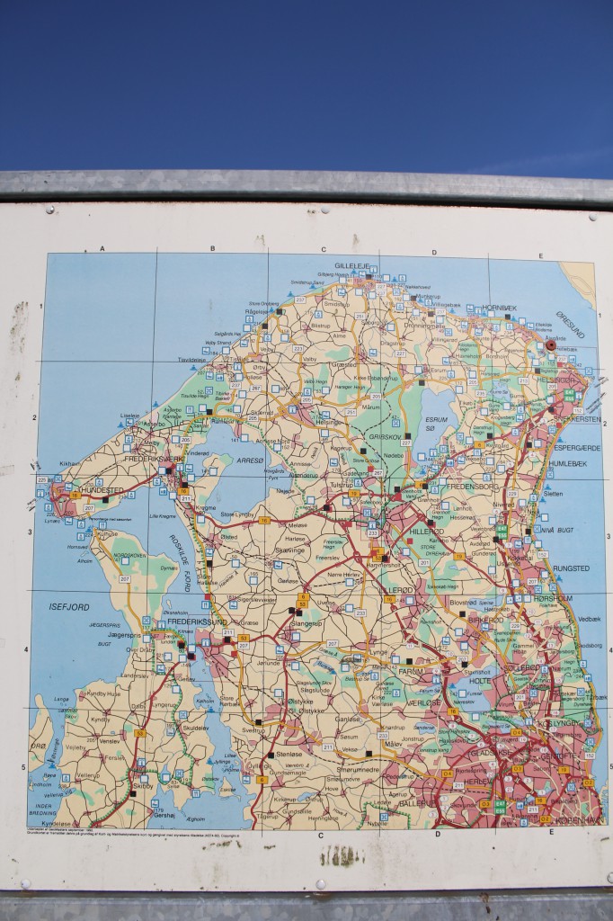
Map of North Sealand, Denmark:
Map of North Sealand, Denmark. Photo august 2013 by Erik K Abrahamsen
PART 3
Elsinore Municipality
Elsinore Municipality has an extend from Hornbaek and Esrum Lake in west to Øresund with the cities Elsinore, Snekkersten and Espergaerde in east. In North to Kattegat Sea and south to Fredensborg.
Elsinore Municipality
SUMMER AND LATE SUMMER
BEACH
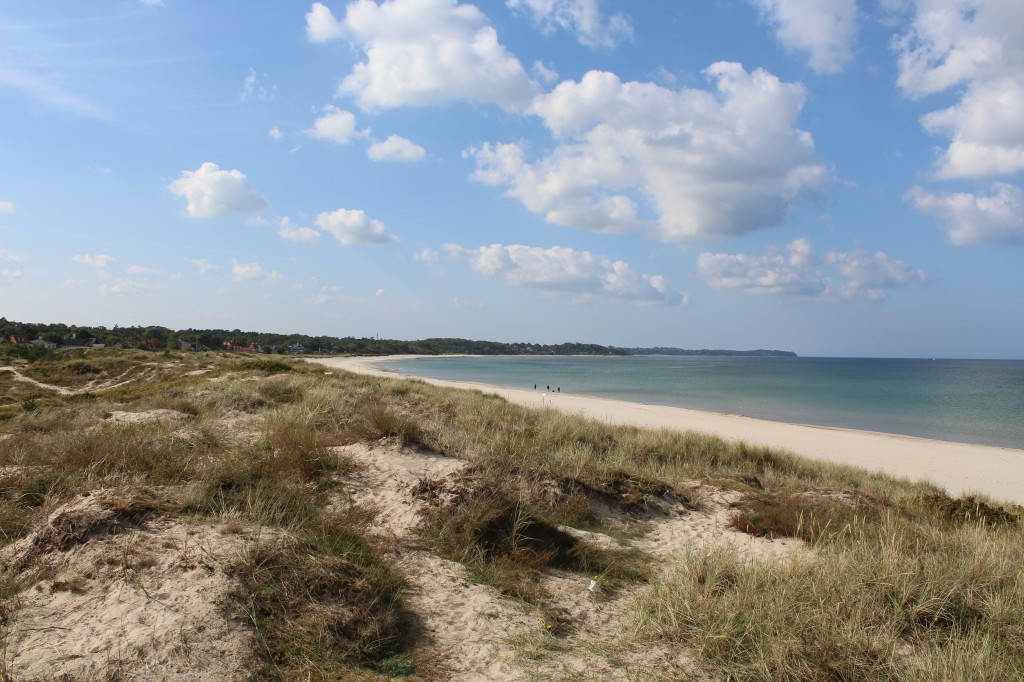
Villingebaek Beach at Kattegat Sea, North Sealand:

Hornbaek Beach:

Hornbaek Beach – view to Hornbaek Harbour:

Click on he photos and use your zoom control and you see them in full screen size.
Hornbaek Harbour and Beach:

Hornbaek Harbour – view to Kullen Hills in Sweden:

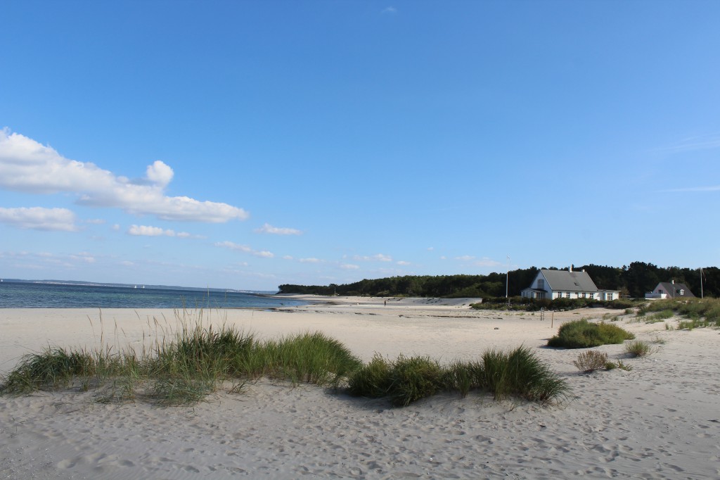
Hornbaek Plantation Beach:

Hornbeak Plantation Beach:

Hornbaek Plantation Beach:

Hornbaek Plantation:

Click on the photos and use your zoom control and you see them in full screen size.
Hellebaek Beach, Elsinore Municipality, North Sealand:

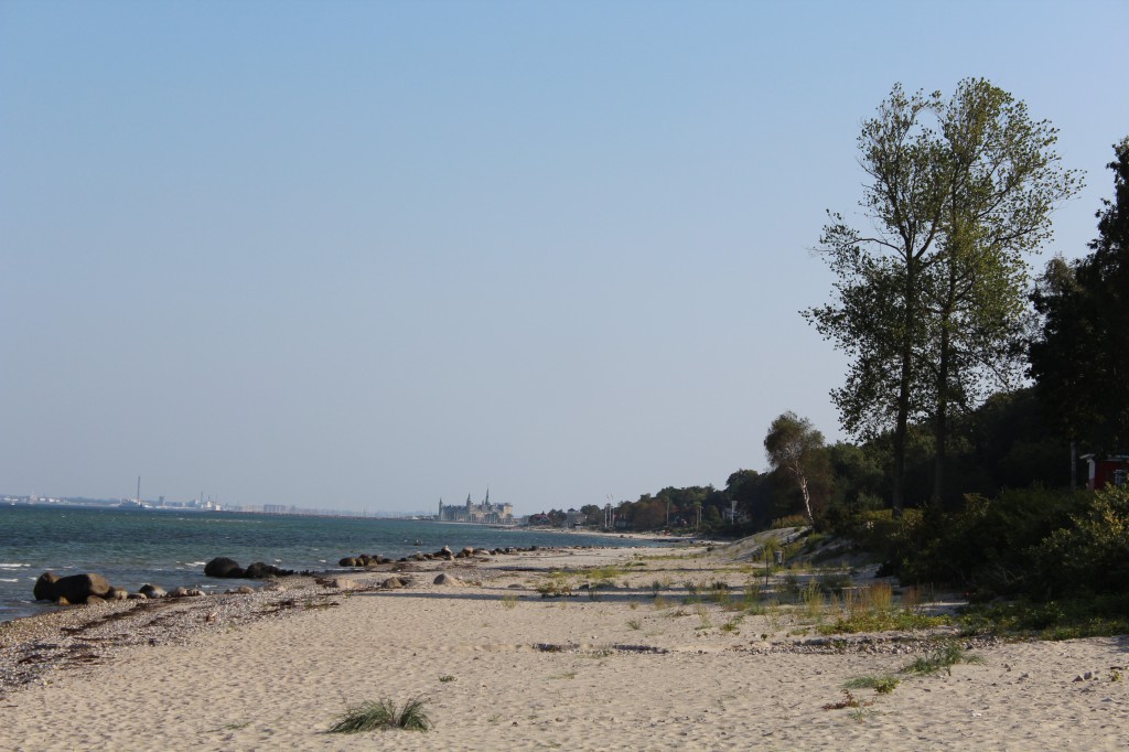
Hellebaek Beach – view in direction south to Elsinore and Kronborg Castle:

Julebaek Beach – view in direction south to Kronborg Castle, Elsinore:

Click on the photos and use your zoom control and you see them in full screen size.
Map of North Sealand:

The light over Elsinore.
Kronborg Castle, Elsinore:
Kronborg Castle with “Flagbastionen” in front of the castle with guns pointing in direction Øresund. Founded as Fortress “Krogen” by King Erik of Pommern (King of Denmark and Norway 1412-39) in 1427 and extended by King Frederik 2 (King of Denmark and Norway 1559-88) in 1574-85 as a Nederlandsk-Renaissance Castle with 4 bastions, ramparts and moats. Photo: 2008 by Erik K Abrahamsen.
The light over Elsinore town:
Elsinore, North Sealand, Denmark. In 1426 King Erik 7 of Pommern gave the town merchants privilege to develope commerce (Købstadsprivilegier). With the introduction of the “Sundtolden” all ships in and out of the Baltic Sea had to ancher at Elsinore to pay the tax. That gave the ships time to buy proviant from the merchants in Elsinore. Elsinore expanded in size, inhabitants and wealth the next 4-500 hundreds years. Today there are hundreds of buildings more then 2-400 years old all over the town. Here on the picture 5 small houses from 17-1800 at neighbour to Karmeliter Monastery and “Karmeliterhuset” from 1516-90 and today Elsinore Town Museum. In the background: The Cathedral Sct Olai builded 1400- 1521. Photo: 7. october 2011 by Erik K Abrahamsen.
Elsinore:
Karmeliter Monastery.
Karmeliter Monastery in Elsinore. In front the east wing of the monastery. At left Sct. Mariae Church as south wing of the monastery. View from the monastery garden. Karmeliter Monastery founded 1430 and builded from 1450-1500. Photo: 7. october 2011 by Erik K Abrahamsen.
King Erik 7 of Pommern (King of Denmark and Norway 1412-39) needed money to rule Denmark and ordered all ships sailing through the danish straights to pay for passing. In the straights of Øresund all ships to The Baltic Sea had to stop in Elsinore to pay the tax: Sundtolden. To set force behind his decision he builded the fortress “Krogen” on a point at the seashore of Øresund in Elsinore. The fortress “Krogen” was rebild and enlarged by King Frederik 2 in 1574-85 in style Nederlandsk-Renaissance and got the name Kronborg Castle.
To help the town of Elsinore to expand economicaly The king Erik 7 builded facilities for the ships on ancher in Elsinore to buy proviants to the ships. This gave birth to wealth and a international atmosphere the next centuries in Elsinore.
Kronborg Castle and Fortress was extended by King Frederik 2 (King of Denmark and Norway 1559-88) from 1574-85 to a brilliant Renaissance Castle with brickwork construction of sandstone and roof of cupper and with 4 bastions, ramparts and moats. After a big fire in 1629 which destroyed big parts of the castle except the church Kong Christian 4 (King of Denmark and Norway 1588-1648) rebuilded it to what you see today.
The outer defence line with moat and rampart builded by King Christian 5 in 1690 to protect against invasion. View to the west wing of Kronborg Castle. The bridge at right leads to Württembergs Ravelin and the main entrance: “Kronværksporten”. Photo: 13. october 2011 by Erik K Abrahamsen.
I will finished this article about LIGHT OVER NORTH SEALAND with this photo:
Double rainbow over Liseleje Beach, North Sealand, Denmark summer 2013:
The inner primary rainbow is the inner circle, where the light is refracted one time in the water drops and shows colors from outside of the circle: red, orange, yellow, green, blue and violet.
The outer secondary rainbow is made of light which is refracted 2 times in the water drops in the atmosphere and produce colors opposite from outside of the circle: violet, blue, green, yellow, orange and red.
Between the two rainbows is an area called ALEXANDER DARK BAND with subdued light.
About the future “Nationalpark Kongernes Nordsjælland” (“National Parc Kings North Sealand”) you can read and see a map of its extend: seek GOOGLE and wright “Naturskolens Blog”.
Click on the photos and use your zoom control and you can see them in full screen size.
Text and Photos Copyright Erik K Abrahamsen 2014
All rights reserved
Melby, North Sealand, 14. november 2014
Best wishes
Erik


